- total area: 1.267 million sq km
- country comparison to the the U.S.: slightly less than twice the size of Texas
- landarea: 1,266,700 sq km
- water area: 300 sq km
- total land boundaries: 5,697 km
- border countries: Algeria 956 km, Benin 266 km, Burkina Faso 628 km, Chad 1,175 km, Libya 354 km, Mali 821 km, Nigeria 1,497 km
- coastline: 0 km (landlocked)
- Climate: desert; mostly hot, dry, dusty; tropical in extreme south
- Terrain: predominately desert plains and sand dunes; flat to rolling plains in south; hills in north
- lowest point: Niger River 200 m
- highest point: Idoukal-n-Taghes 2,022 m
Maps of Niger!!
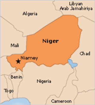
Regional map of Niger!

Country specific map of Niger!!
